
Gifford Pinchot National Forest
The Gifford Pinchot National Forest is one of the oldest National Forests in the United States. Included as part of the Mount Rainier Forest Reserve in 1897, this area was set aside as the Columbia National Forest in 1908. It was renamed the Gifford Pinchot National Forest in 1949. Whether you seek solitude, social activity, creative inspiration, wildlife, forest products or scenic beauty, you can find it in the Gifford Pinchot National Forest. We invite you to enjoy the many different aspects of your National Forest.
Located in southwest Washington State, the Gifford Pinchot National Forest encompasses 1,312,000 acres and includes the 110,000-acre Mount St. Helens National Volcanic Monument, established by Congress in 1982.

Okanogan-Wenatchee National Forest
The Okanogan-Wenatchee National Forest encompasses more than 4-million acres in Washington state and stretches north to south from the Canadian border to the Goat Rocks Wilderness – a distance of about 180 miles. The forest lies east of the Cascade Crest, which defines its western boundary. The eastern edge of the forest extends into the Okanogan highlands, then south along the Okanogan and Columbia Rivers, and then to the Yakima River valley. Because of this wide geographic range, the forest is very diverse – from the high, glaciated alpine peaks along the Cascade Crest and the numerous mountain ranges extending eastward from the crest, through deep, lush valleys of old growth forest, to the dry and rugged shrub-steppe country at its eastern edge. Elevations range from below 1,000 ft. to over 9,000 ft. Precipitation varies widely – from more than 70-inches along the crest to less than 10-inches at its eastern edge. This of course greatly affects the forest and vegetation types across the area.
The Okanogan-Wenatchee National Forest is most noted for a wide range of recreation opportunities. There truly is “something for everyone” who likes to have fun in the outdoors.
Pike & San Isabel National Forest
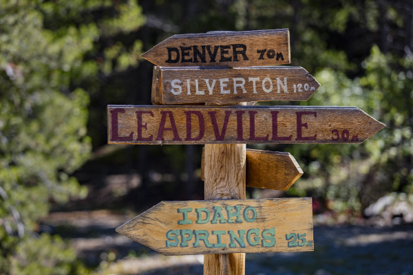
The Pike San Isabel National Forest and Cimarron and Comanche National Grasslands (PSICC) are comprised of 2 national forests and 2 national grasslands throughout Colorado, Kansas. The PSICC covers nearly 3 million acres, between the prairies of western Kansas and some of Colorado’s highest mountain peaks along the Continental Divide. These sprawling forests and grasslands are an eight hour drive from boundary to boundary. This landscape offers a variety of ecosystems rich in history, geology, scenery, wildlife habitat and recreation opportunities.
Rocky Mountain Recreation Company Operates all of the developed campgrounds in the Pike and San Isabel Forests. This forest draws crowds of all types, from fisherman to horseback riders, from family reunion groups to small backpacking duos, from atv riders to downhill mountain bikers, it is a diverse and large forest where almost any recreational activity can be had.
San Juan National Forest
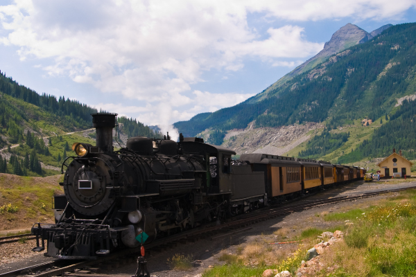
The San Juan National Forest encompasses about 1.8 million acres in the southwestern corner of Colorado. Terrain ranges from high-desert mesas to alpine peaks, with thousands of miles of back roads and hundreds of miles of trails to explore. These federal lands are managed for multiple uses; visitors are asked to respect each other and the natural resources.
Rocky Mountain Recreation operates all of the developed campgrounds in the San Juan National Forest. Horse, bike and hiking trails are extremely popular in this area. The town of Durango is the hub for this forest and an amazing historical location full of entertainment and recreational activities.
Sequoia National Forest
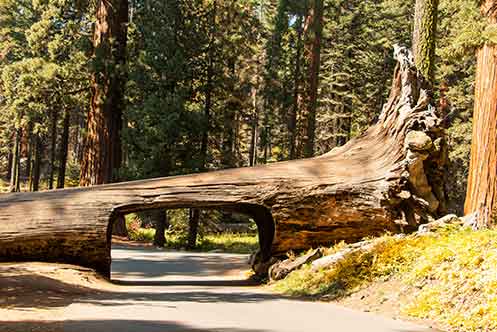
The Sequoia National Forest covers over 1.1 million acres in three counties of Southern California and offers an abundance of recreation opportunities for people to enjoy. The Forest offers 52 developed campgrounds, hiking on more than 1,147 miles of trails including 47 miles of the PCT, over 314,448 acres of wilderness, 222 miles of Wild and Scenic Rivers, 2,617 rivers and streams, world-class whitewater rapids, 158 ponds and lakes, boating, fishing, biking, horseback riding and more.
Custer Gallatin National Forest
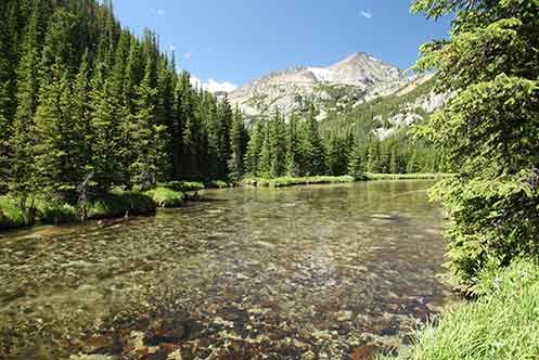
With over 3 million acres stretching across 7 ranger districts, the Custer Gallatin National Forest is known as one of the most ecologically diverse landscapes in the area. The Forest stretches from southcentral Montana to northwestern South Dakota and allows visitors to explore large wilderness landscapes, high peaks, rolling hills and vast stretches of open prairie intermixed with green islands alongside streams, lakes and rivers.
The Forest hosts three gateways to Yellowstone National Park, over a million acres of Wilderness between the Absaroka-Beartooth Wilderness and the Lee Metcalf Wilderness and features adventures among rugged mountains, including the tallest Peak in Montana to the remote buttes and bluffs of southeastern Montana and northwestern South Dakota.

Apache Sitgreaves National Forest
The Apache-Sitgreaves National Forests, administered as one national forest, encompasses over two million acres of magnificent mountain country in east-central Arizona.
On the Sitgreaves, the major attractions for the visitors from the desert are the Mogollon Rim and eight cold-water lakes. From the Mogollon (pronounced: muggy-own) Rim’s 7,600- foot elevation, vista points provide inspiring views of the low lands to the south. The Rim extends two hundred miles from Flagstaff into western New Mexico.
The Apache National Forest ranges in elevation from 3,500 feet to nearly 11,500 feet and is named for the tribes that settled in this area. The area from Mount Baldy east to Escudilla Mountain is often referred to as the White Mountains of Arizona. From the edge of the Mogollon Rim south of Hannagan Meadow, the land drops precipitously into the high desert around Clifton.
Coconino National Forest
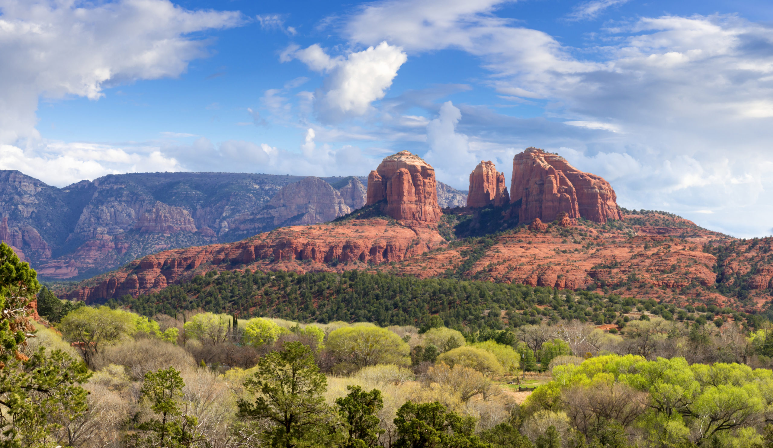
One of the most diverse National Forests in the country with changing landscapes and activities around every corner. Explore mountains and canyons, fish in small lakes, and wade in lazy creeks and streams. Bring your camera and don’t forget your swim suit, hiking shoes, and fishing pole… Come and see!

Gifford Pinchot National Forest
The Gifford Pinchot National Forest is one of the oldest National Forests in the United States. Included as part of the Mount Rainier Forest Reserve in 1897, this area was set aside as the Columbia National Forest in 1908. It was renamed the Gifford Pinchot National Forest in 1949. Whether you seek solitude, social activity, creative inspiration, wildlife, forest products or scenic beauty, you can find it in the Gifford Pinchot National Forest. We invite you to enjoy the many different aspects of your National Forest.
Located in southwest Washington State, the Gifford Pinchot National Forest encompasses 1,312,000 acres and includes the 110,000-acre Mount St. Helens National Volcanic Monument, established by Congress in 1982.

Okanogan-Wenatchee National Forest
The Okanogan-Wenatchee National Forest encompasses more than 4-million acres in Washington state and stretches north to south from the Canadian border to the Goat Rocks Wilderness – a distance of about 180 miles. The forest lies east of the Cascade Crest, which defines its western boundary. The eastern edge of the forest extends into the Okanogan highlands, then south along the Okanogan and Columbia Rivers, and then to the Yakima River valley. Because of this wide geographic range, the forest is very diverse – from the high, glaciated alpine peaks along the Cascade Crest and the numerous mountain ranges extending eastward from the crest, through deep, lush valleys of old growth forest, to the dry and rugged shrub-steppe country at its eastern edge. Elevations range from below 1,000 ft. to over 9,000 ft. Precipitation varies widely – from more than 70-inches along the crest to less than 10-inches at its eastern edge. This of course greatly affects the forest and vegetation types across the area.
The Okanogan-Wenatchee National Forest is most noted for a wide range of recreation opportunities. There truly is “something for everyone” who likes to have fun in the outdoors.

Pike & San Isabel National Forest
The Pike San Isabel National Forest and Cimarron and Comanche National Grasslands (PSICC) are comprised of 2 national forests and 2 national grasslands throughout Colorado, Kansas. The PSICC covers nearly 3 million acres, between the prairies of western Kansas and some of Colorado’s highest mountain peaks along the Continental Divide. These sprawling forests and grasslands are an eight hour drive from boundary to boundary. This landscape offers a variety of ecosystems rich in history, geology, scenery, wildlife habitat and recreation opportunities. Rocky Mountain Recreation Company Operates all of the developed campgrounds in the Pike and San Isabel Forests. This forest draws crowds of all types, from fisherman to horseback riders, from family reunion groups to small backpacking duos, from atv riders to downhill mountain bikers, it is a diverse and large forest where almost any recreational activity can be had.

San Juan National Forest
The San Juan National Forest encompasses about 1.8 million acres in the southwestern corner of Colorado. Terrain ranges from high-desert mesas to alpine peaks, with thousands of miles of back roads and hundreds of miles of trails to explore. These federal lands are managed for multiple uses; visitors are asked to respect each other and the natural resources. Rocky Mountain Recreation operates all of the developed campgrounds in the San Juan National Forest. Horse, bike and hiking trails are extremely popular in this area. The town of Durango is the hub for this forest and an amazing historical location full of entertainment and recreational activities.

Sequoia National Forest
The Sequoia National Forest covers over 1.1 million acres in three counties of Southern California and offers an abundance of recreation opportunities for people to enjoy. The Forest offers 52 developed campgrounds, hiking on more than 1,147 miles of trails including 47 miles of the PCT, over 314,448 acres of wilderness, 222 miles of Wild and Scenic Rivers, 2,617 rivers and streams, world-class whitewater rapids, 158 ponds and lakes, boating, fishing, biking, horseback riding and more.

Custer Gallatin National Forest
With over 3 million acres stretching across 7 ranger districts, the Custer Gallatin National Forest is known as one of the most ecologically diverse landscapes in the area. The Forest stretches from southcentral Montana to northwestern South Dakota and allows visitors to explore large wilderness landscapes, high peaks, rolling hills and vast stretches of open prairie intermixed with green islands alongside streams, lakes and rivers.
The Forest hosts three gateways to Yellowstone National Park, over a million acres of Wilderness between the Absaroka-Beartooth Wilderness and the Lee Metcalf Wilderness and features adventures among rugged mountains, including the tallest Peak in Montana to the remote buttes and bluffs of southeastern Montana and northwestern South Dakota.

Apache Sitgreaves National Forest
The Apache-Sitgreaves National Forests, administered as one national forest, encompasses over two million acres of magnificent mountain country in east-central Arizona.
On the Sitgreaves, the major attractions for the visitors from the desert are the Mogollon Rim and eight cold-water lakes. From the Mogollon (pronounced: muggy-own) Rim’s 7,600- foot elevation, vista points provide inspiring views of the low lands to the south. The Rim extends two hundred miles from Flagstaff into western New Mexico.
The Apache National Forest ranges in elevation from 3,500 feet to nearly 11,500 feet and is named for the tribes that settled in this area. The area from Mount Baldy east to Escudilla Mountain is often referred to as the White Mountains of Arizona. From the edge of the Mogollon Rim south of Hannagan Meadow, the land drops precipitously into the high desert around Clifton.