
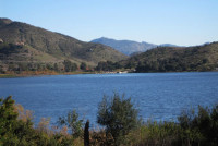
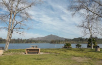
Castaic Lake is located within the Angeles National Forest just 15 minutes north of Six Flags Magic Mountain and 5 minutes from I-5. Castaic Lake is a holding reservoir for part of the western regions irrigation water supply. The Castaic Lake Dam is 425 feet high and holds 350,000 acre feet of water at full capacity. Castaic Lake is surrounded by 8,800 acres of recreational land. Castaic Lake consists of two bodies of water; the upper or main lake which has approximately 29 miles of shoreline and the lagoon or lower lake has approximately 2 miles of shoreline.
All boats are rented on a first come first serve basis. No Reservations. Boats can be rented from 7:00am – 1:45pm with the last boat returning at 4:00pm.
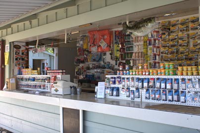
Camp Store is only open on Saturday
Saturday – 8:00am – 8:00pm
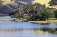
Del Valle Lake is located 10 miles south of Livermore off Interstate 580 in the San Francisco East Bay area. The lake is surrounded by over 5,000 acres of beautiful oak-covered hills at an altitude of 745 feet. The water level at Del Valle Lake fluctuates seasonally from a high of 703 feet in the summer to a low of 678 feet in the winter. The lake stretches for 5 miles and has 16 miles of shoreline.
Lake Del Valle contains algae but no toxins.
ATTENTION: SHADOW CLIFFS BOAT RENTALS AND CONCESSIONS IS CLOSED FOR THE SEASON
Shadow Cliffs is situated only a mile from downtown Pleasanton on Stanley Boulevard. Swimming, fishing and non-motorized boats are allowed at the park. The park was formerly a gravel quarry and was donated to the Park District; 266-acres have been developed with an 80-acre lake, parking and picnic grounds. An arroyo with a chain of smaller lakes and ponds provides retreats on hot summer days.
Lake Hodges is a lake and reservoir located in Southern California, about 31 miles north of San Diego and just south of Escondido, California. When full, the reservoir has 1,234 acres, a maximum water depth of 115 feet and 27 miles of shoreline. Lake Hodges is owned by the city of San Diego, and supplies water to the San Dieguito Water District and Santa Fe Irrigation District.
The recreation area has six barbecues and 12 picnic tables. Self contained gas barbecues are allowed in the picnic area. Ground fires, glass containers and camping are not allowed at the park. There is currently no drinking fountain. Make sure to bring your own water.
Lower Otay Lake is an artificial lake in San Diego County, California, flanked by Otay County Open Space Preserve and Chula Vista. The reservoir is formed by impounding the waters of the Otay River, behind Savage Dam, completed in 1918, and is the terminus for the Second San Diego Aqueduct. When full, Lower Otay Reservoir has 1,100 surface acres, a maximum water depth of 137.5 feet, and 25 shoreline miles. Lower Otay Reservoir is owned by the City of San Diego and is the home of the United States Olympic Training center for rowing sports.
Lower Otay’s picnic area has 13 barbecues and 16 picnic tables. Visitors can bring self contained gas barbecues for use in designated areas only. Ground fires, glass containers and camping are not allowed at the park.
Upper Otay Lake was established in 1959 and is the smallest of San Diego’s reservoirs with only 20 surface acres when full. The reservoir is an active hatchery and breeding ground for the Florida-strain largemouth bass. It is one of two reservoirs in San Diego County that has a catch-and-release only fishing program.
Upper Otay does not have any barbecues or picnic tables. Visitors can bring self contained gas barbecues for use in designated areas only. Ground fires, glass containers and camping are not allowed at the park.
ATTENTION: LAKE MIRAMAR CONCESSIONS AND BOAT RENTALS ARE NOW CLOSED
Lake Miramar is a reservoir located in the Scripps Miramar Ranch community of San Diego, California. Owned, operated and maintained by the City of San Diego, the reservoir was completed in 1960 as part of the second San Diego Aqueduct project. Water flowing south to the reservoir originates from both the Colorado River Aqueduct and the California Aqueduct, brought into San Diego by the San Diego County Water Authority.
Lake Miramar is a popular recreation site. Activities include boating, fishing, picnicking, and the use of an over 5-mile-long trail wrapping around the lake. There are 18 barbecues and 48 picnic tables for family outings. Self-contained gas barbecues are allowed in designated areas. Ground fires, glass containers and camping are not allowed at the park.
Lake Murray is a reservoir in San Diego, California, owned by the City of San Diego’s Public Utilities Department. It is located within Mission Trails Regional Park. At full capacity the depth is 95 ft (29 m). The asphalt-paved service road lining roughly two-thirds of the lake’s perimeter is a popular recreation site for the Navajo community. It lies south of Cowles Mountain and is an important reporting point for aircraft inbound to land at Montgomery Field airport.
Lake Murray is a popular site for hikers, bicyclists and runners who move around the periphery of the lake. Kayaking and fishing are both allowed on the reservoir. Birdwatchers enjoy visiting Lake Murray where ducks, geese and herons abound. At least 149 bird species have been observed and recorded at Lake Murray.
There are 64 picnic tables located around the lake. Patrons can bring their own barbecues for use in designated areas only. Ground fires, glass containers and camping are not allowed at the park.
WILL BE CLOSING NOVEMBER 10, 2024, FOR THE SEASON AND WILL REOPEN FEBRUARY 7, 2025.
Boat rental availability is contingent on the weather. We are unable to conduct boat inspections under wet conditions. For best results on personal boats, the boat must be banded.
For a full list of Rules & Regulations at the Park visit http://www.ebmud.com/recreation/rules-and-regulations/
Invasive Mussel Prevention:
https://www.ebmud.com/recreation/protecting-natural-habitat/invasive-mussel-prevention
Pet Rules
Pets are allowed on paved roads & the developed picnic areas only.
Must be on a leash at all times.
Not allowed in boats or on the shoreline
Do not leave unattended.
The San Pablo Reservoir Recreation Area offers exciting outdoor activities including fishing, boating, picnicking, kayaking and hiking. The park also has facilities for group events, weddings and meetings. San Pablo Recreation Area is located off San Pablo Dam Road between Orinda and El Sobrante.
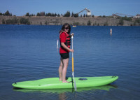
Swimming and Paddle Boarding are not permitted at this lake, thank you for your cooperation.
 Current weather/conditions at Santa Margarita!
Created by the construction of the Salinas Dam in 1941, Santa Margarita Lake was originally designed to furnish water to Camp San Luis Obispo. Today, swimming in the lake is not permitted as it is the drinking water reservoir for the City of San Luis Obispo.
Beyond the developed area of the park, Santa Margarita Lake natural area represents several thousand acres of designated open space. This section of the park is managed for its natural resource values, passive recreational use, and environmental education opportunities. The area is accessible to hikers, bicyclists and equestrians. Motor vehicles are not permitted in the natural area. With thousands of acres of unspoiled open space, the park is home to countless species of plants and wildlife making it the perfect location for nature study, boating, and fishing.
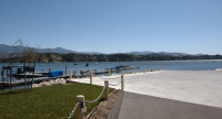
Silverwood Lake is located off Highway 138, 11 miles east of the I-15 or 24 miles northeast of San Bernardino from highways 18 and 138. Silverwood Lake is surrounded by 2,400 acres of ancient Douglas Firs, Black Oak trees and spectacular views of the mountain creeks. At an altitude of 3,380, Silverwood Lake was formed by the 249-foot Cedar Springs Dam; at 3,350 feet it is the highest reservoir hosted by the State Water Project. The lake has a surface area of 976 acres and has 13 miles of shoreline.
Lake Skinner Park is located about 90 miles south of Los Angeles ,off the 215 freeway, 12 miles east of Temecula. It is also with in easy reach of the 15 freeway off Rancho California Road. The surface area of the lake is about 1200 acres and about 12 miles of shoreline. A 6,000-acre park surrounds the lake.
See why we love Lake Skinner:

San Vicente is a deep, steep-sided impounding reservoir on San Vicente Creek, approximately 25 miles northeast of San Diego. It currently has a depth of 306.00 feet when full. Water levels are monitored weekly.
The San Diego County Water Authority oversaw the construction of the San Vicente Dam Raise Project, which began in early 2009. The San Vicente Dam Raise Project is part of the Water Authority’s more than $1 billion Emergency Storage Project, which is creating new emergency water storage and pipeline connections to deliver water throughout the region if our imported water supply is disrupted. Now complete, the reservoir is able to store an additional 152,000 acre-feet of water supply.
The Gopher Hole Store is located conveniently just past the entrance kiosk of Rancho Jurupa Park, visitors the chance for a quick stop to grab supplies, or a chat with the friendly staff for fishing conditions and other park news. The Store provides a wide variety of bait and tackle selected specifically for the fish in the lake, along with California state fishing licenses, making it the one-stop shop for fishermen. The Gopher Hole Store also accommodates campers, stocking everything from ice to snacks to propane. Open 7 days a week, the staff is always there to give you a hand; especially when you need extra s’mores supplies! For entertainment, guests can purchase a disc golf for the nearby course, or go mini golfing just outside the store!
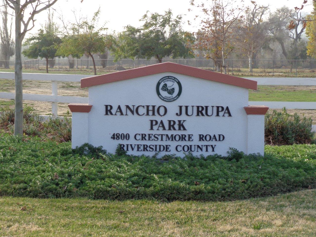
Rancho Jurupa Park is a spacious 200-acre recreation area with plenty of activities to entertain all visitors. Located behind Mt. Rubidoux, along the Santa Ana River, the park offers a beautiful retreat, without a long drive from the city. The park offers two 3-acre lakes for fishing, 140 over-night camping sites for tent & RV campers, disc golf, mini golf, a summer time splash pad, hiking trails, picnic areas, playgrounds, and rock climbing.
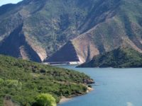
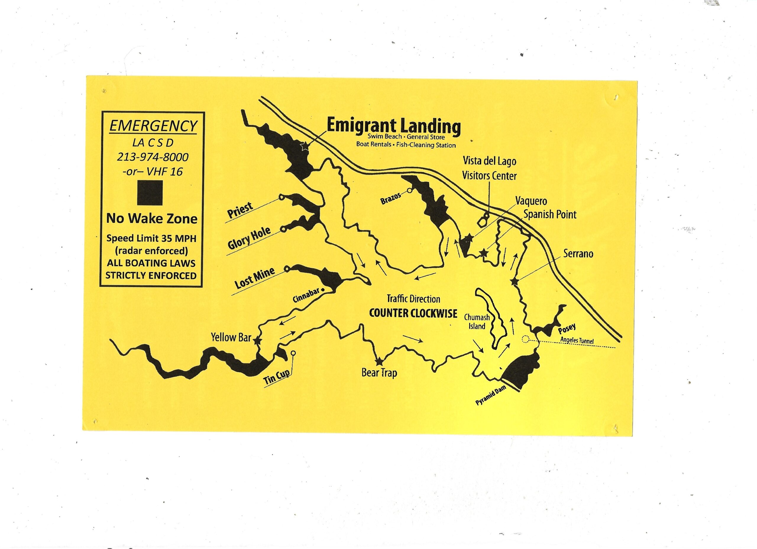
Built in 1972, Pyramid Lake was created as a holding reservoir for the California State Water Project. This 180,000 acre reservoir is placed between the Angeles National Forest and the Los Padres National Forest, at the Northwest portion of Los Angeles County. The reservoir is west of Interstate 5, south of Tejon Pass; accessed from exit 195 off of the I-5 (Smoky Bear Road), turn left on Pyramid Lake Road.
Named after the Pyramid-shaped rock carved while building Route 99, Pyramid Lake offers a variety of activities including boating, fishing, camping, swimming, jet skiing, and hiking. The reservoir provides ample room for picnicking including 3 unique day use areas that are accessible by boat only!
To operate a PRIVATE boat/ vessel on Pyramid Lake, you need a California Boater’s Safety Card. Renters of watercraft do not apply to this.
For more information, please visit http://www.californiaboatercard.com.
Please See the links Below about Boater Safety Courses
Public Education Course Flyer Boat America
** BOAT RENTALS ARE AVAILABLE! **
** CHECK IN TIME IS NOW 2PM & CHECK OUT TIME IS 11AM FOR OVERNIGHT CAMPING. THERE IS NO EARLY CHECK IN.**
Please call 1-800-416-6992 or CLICK HERE, to make reservations. At least a 3-day notice is required to make a reservation. Cancellations and rescheduling must be made at least 3 days prior to your reservations date.
Rancho Seco Recreational Area is a 400-acre park overflowing with recreational opportunities including camping, boating, fishing, swimming and wildlife viewing. The 160-acre lake is fed by the Folsom South Canal and is a great year-round day or overnight getaway located in California’s Central Valley, just 25 miles from downtown Sacramento.
Note to our Patrons: In order to deliver recreational experience that meet our customers’ expectations, SMUD has made significant infrastructure improvements to the park over the past several years and these have increased annual maintenance and operating costs. Those improvements were necessary to keep the park safe, clean and accessible to all. Infrastructure improvements include new shade structures, restrooms, shower facilities, laundry facilities and more. Thank you for your continued support as a patron of Rancho Seco Recreational Area.
Please call 1-800-416-6992 or CLICK HERE, to make reservations. At least a 3-day notice is required to make a reservation. Cancellations and rescheduling must be made at least 3 days prior to your reservations date. THERE IS NO CAMPING AT THE MOMENT AT PARDEE LAKE.
Pardee Recreation Area has been creating positive memories for visitors since its opening in 1958. Located along the Mokeumne River, Pardee Recreation Area provides stunning views and diverse activities for all visitors, old and young. The park lays in the foothills of the Sierra Nevada Mountain Range of Northern California and is just twelve miles southwest of Jackson. The facility is reachable from Highway 88 or Highway 12 and is near the Jackson Rancheria Casino. The overwhelming beauty of this recreation area provides for guests a state of peace as they witness the tranquility of geese floating on the water top, excitement as wild turkey dart across their path, and joy as they interact with the friendly staff.
From fishing to hiking, Pardee Recreation Area offers an abundance of activities to keep even the most active groups busy over a long weekend. Over 100 campsites, each with a fire pit and picnic table, are located within the park, interspersed with incredible oak trees that provide plenty of shade for the sites. Two swimming pools, several day use areas, boat rentals, fishing and breathtaking hiking trails make this park full of adventure and areas to explore. The park is also home to several friends including wild turkeys, deer and various fish species. To fuel visitors’ adventures, the Lake Pardee Cafe offers tasty breakfast and lunch options and the best 50/50 Freeze you’ll find.
As the center of EBMUD’s drinking supply, to comply with state law which prohibits body contact with the lake, personal watercrafts, water skiing, and lake swimming are not permitted.
For a brochure to Cachuma Lake, please CLICK HERE.

Current weather/conditions at Cachuma Lake!
Cachuma Lake is located in the Santa Ynez Valley and is approximately 12 miles east of Solvang, CA and 22 miles northwest of Santa Barbara, CA. Lake Cachuma is a non-body contact reservoir lake with a shoreline stretching 42 miles long where you can fish for Bass, Crappie, Trout and Catfish.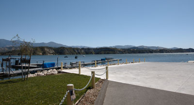
A bait/tackle shop, along with a gas station is located for your convenience on the marina dock. California Fishing & Hunting licenses are also available for purchase at the marina store.